Arequipa or: That Time I Found a Good Coffee

Expectations play a major role in determining overall enjoyment of a place. Sure, some locations (like Torres Del Paine) are almost always viewed in a positive light, but most destinations will see visitors have widely different opinions depending on their expectations beforehand and external factors (e.g. mood, weather, accommodation, travel fatigue or encountering crime) while there.

DSC_3783 edit
Plaza de Armas at dawn

DSC_3868 edit raw

DSC_3823 edit

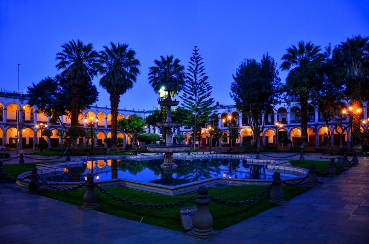
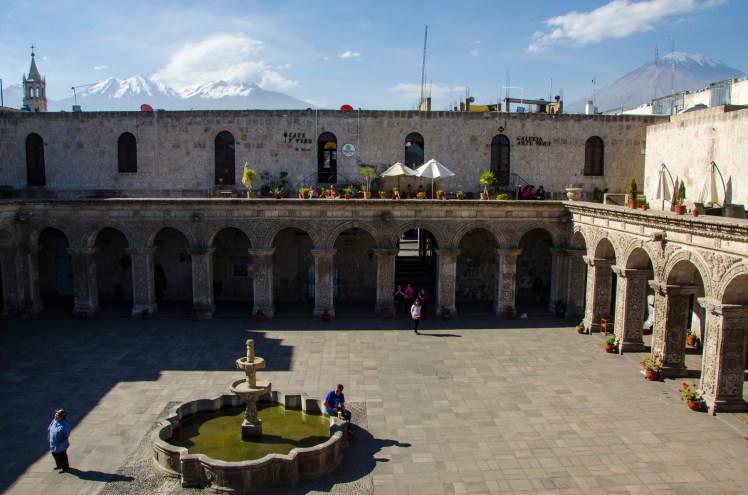
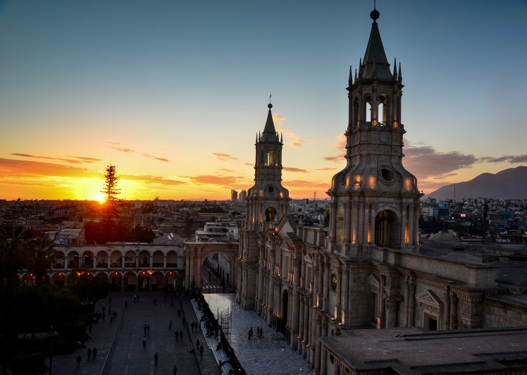
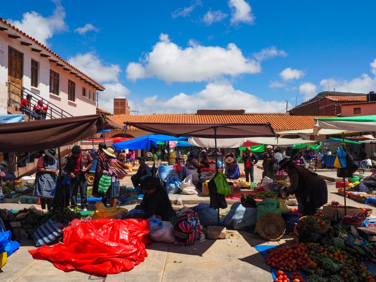
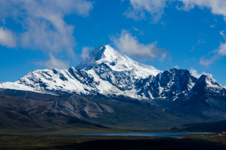
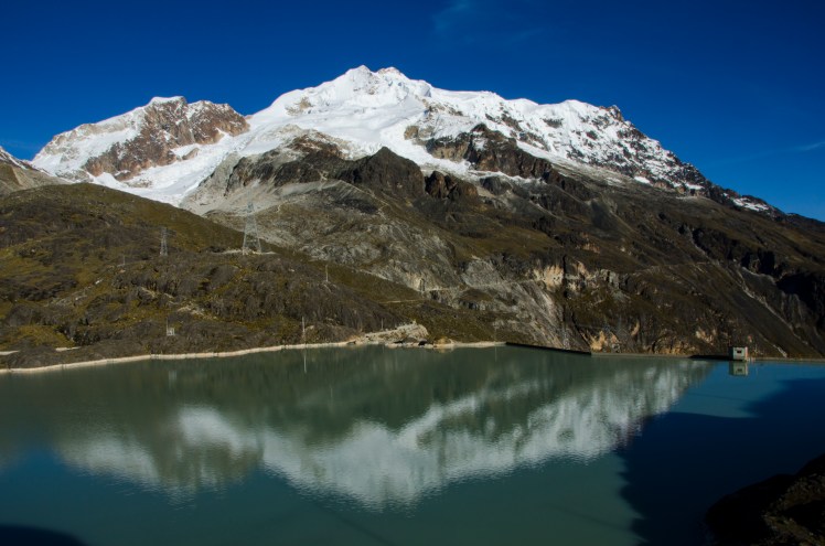
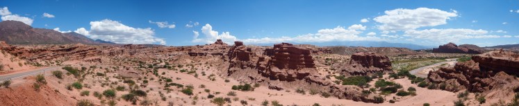
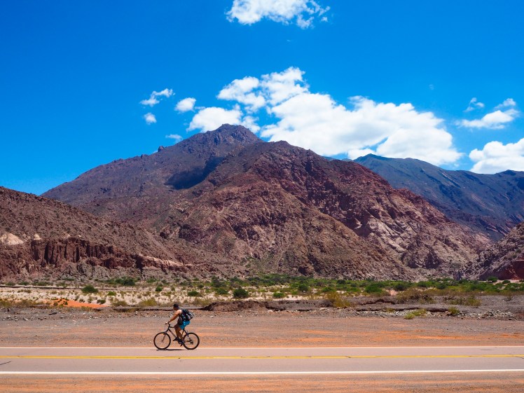
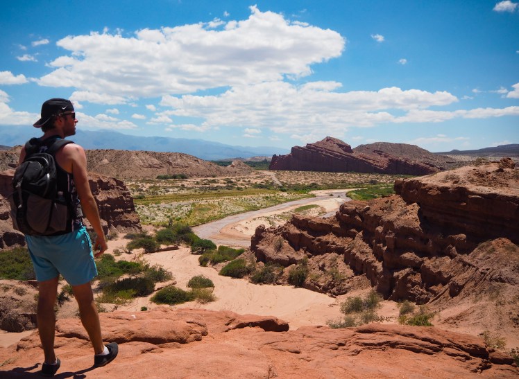
We hadn’t heard a great deal about Arequipa before arriving, and perhaps having no expectations was why I enjoyed it so much. All I knew was that it had a picturesque town centre and was close to a few volcanoes. This was definitely true, and the volcanoes were much closer and more imposing over the city than I had imagined. We arrived at 4.30am after an overnight bus from La Paz, and once we reached the centre I was struck but how clean the cobbled streets and colonial buildings were. We sat in the main square as the sun rose and watched the city slowly wake up. There were a lot of agencies trying to sell Colca Canyon (the second deepest canyon in the world) tours in the Plaza de Armas which could be a little annoying, but it was contained to this area and they didn’t keep hassling after we politely said no.

DSC_3941 edit raw
Volcan Misti
DSC_3910 edit
Sunset at the Plaza
DSC_4411 edit
Inside Colca Canyon
DSC_4562 edit
Looking into the canyon

DSC_4219 edit

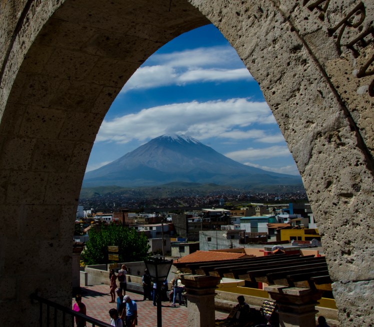
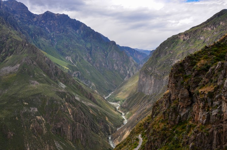
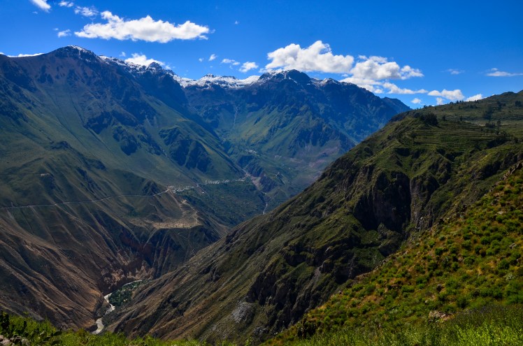
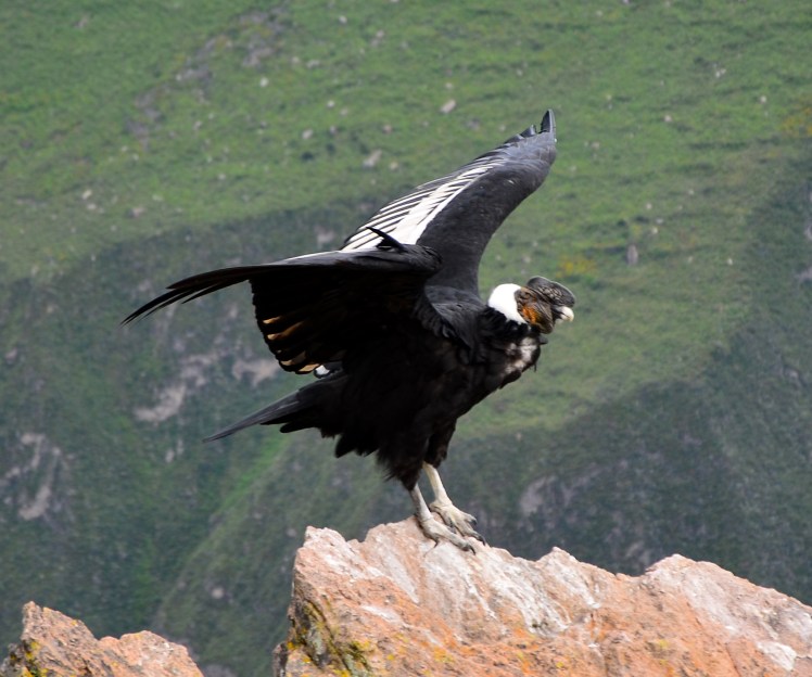
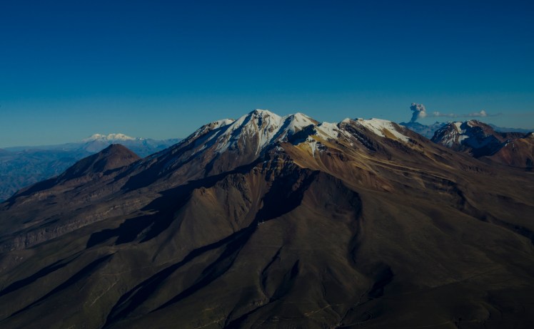
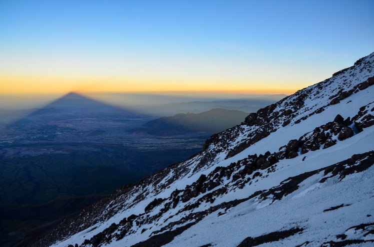
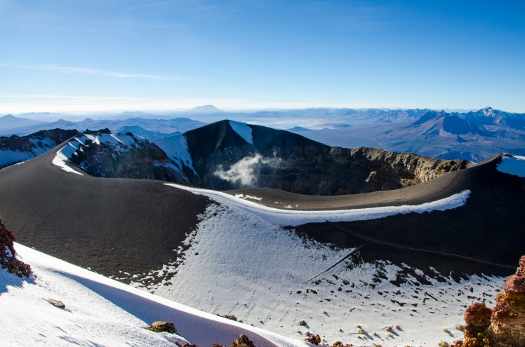
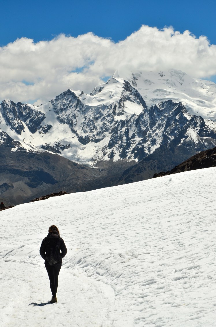
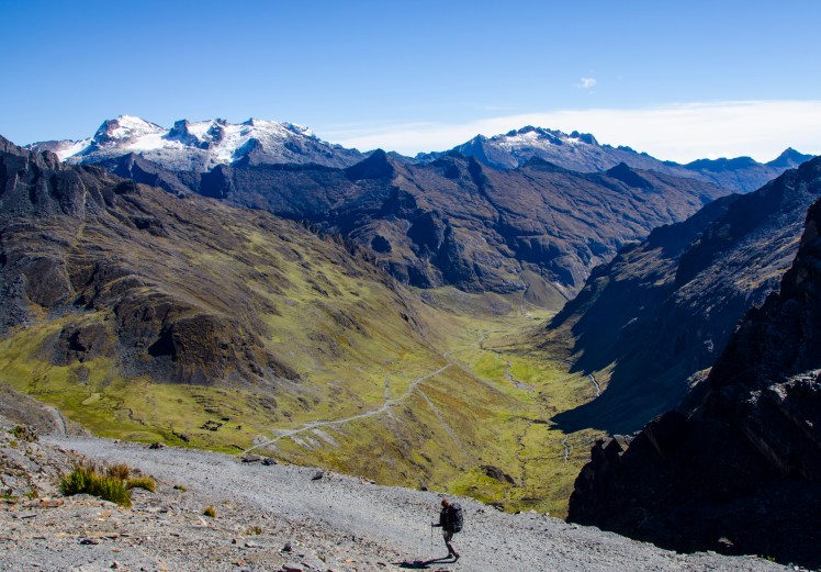
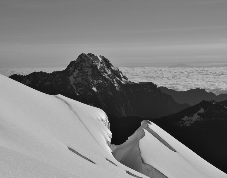
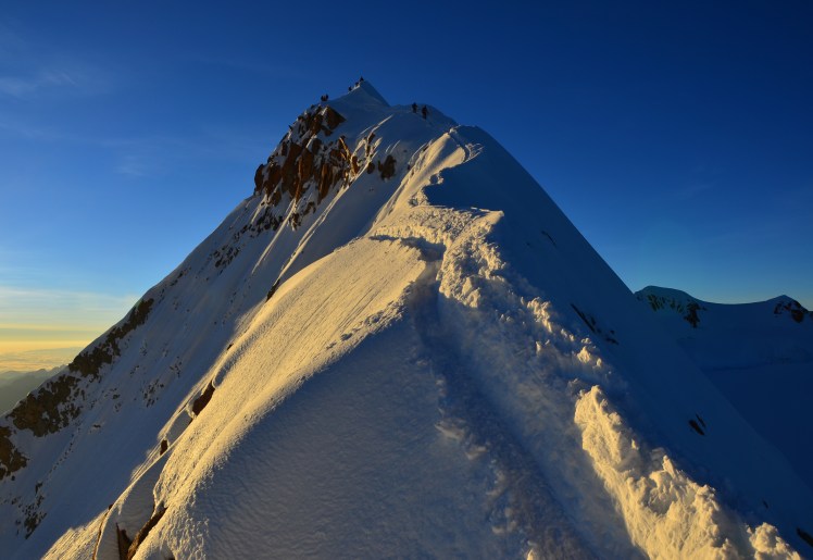
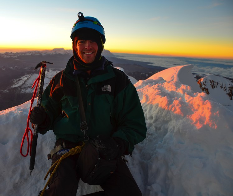
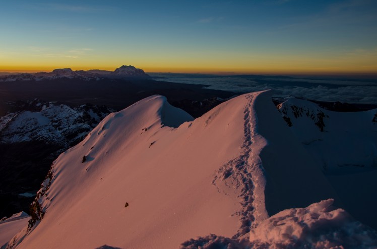
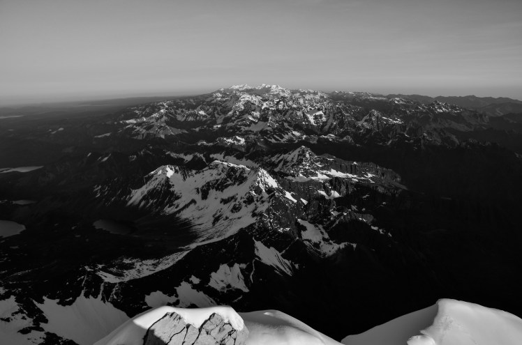
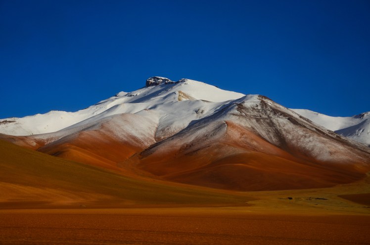
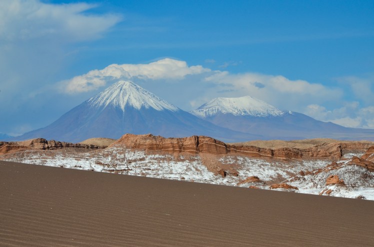
We chose to see Colca Canyon without a tour, which was easily organised and a bit cheaper. The bus we took stopped at the Condor lookout for about 40 minutes and we saw many of these enormous birds from close range. Whilst staying in Cabanaconde we felt four earthquakes, which was a strange experience and a reminder of how active the west coast of the Americas is. When we returned to Arequipa Andrew climbed Volcan Misti, the closest and in my opinion the most impressive looking of the three volcanos that border the city.

DSC_4766 edit raw
Chachani from Misti

DSC_4712 edit

DSC_4768 edit raw
Misti crater

It is no secret that I enjoy food. And coffee. A lot. We reached Arequipa after almost two months in Bolivia, a country not known for its culinary delights. Fried chicken and hot chips dominate most local restaurant menus and street food stalls. Coffee options are either instant, or very weak half froth cappuccino. Whilst this all continued into Peru, the food scene in Arequipa was much more varied. It was also very cheap. I found an excellent café/chocolate shop called Chaqchao that I visited every day and we also did a chocolate making workshop there. It felt like we’d accidentally returned to Australia – they had pallet furniture and I ate a poached egg with avo! The chef who ran the workshop introduced us to cacao tea – tea made from cacao shells that are usually discarded in the chocolate making process. I am convinced that this might be able to cure my after dinner chocolate addiction and am hoping I can send some home or get some back in Australia.

I was torn, almost feeling guilty, by enjoying Arequipa so much. One reason for travelling through South America for such a long time was to experience completely different cultures. And here I was getting really excited about Australian style coffee and food. These kind of luxuries are not necessary to be happy in life, as we saw countless times throughout Bolivia. Nevertheless, it was nice to indulge in some home comforts for a few days.

DSC_4611 edit
Near Colca Canyon. Not really sure what was going on here but it’s the stuff of nightmares.

Erin

Surrounding La Paz

One reason for our disjointed stay in La Paz was that we took some time to explore the surrounding areas of the city. The spectacular location of La Paz, at the foot of the Cordillera Real and close to Lake Titicaca not surprisingly means that there are a number of multi-day treks and scenic day trips that can be done in the area. This fact is obvious the minute you walk around the three or four tourist blocks in the centre of La Paz, where one particular street contains endless travel agencies offering different tours.

The first of our excursions from La Paz was when Claire was still travelling with us, when we spent a couple of nights around Lake Titicaca. It is the highest navigable lake in the world, and an island in the lake, Isla del Sol, is supposedly the birthplace of the first Incans and is therefore a very important place in Incan History.

DSC_1718 edit raw

We spent two nights on Isla del Sol, enjoying the special type of calm that comes from staying on an island with no cars. The northern end of the island has some impressive Incan ruins, and we spent a day walking there and back from our hostel located on a ridge of the southern end of the island.

OLYMPUS DIGITAL CAMERA

These ruins on the northern side are actually the exact location that, according to legend, the first Incans appeared. Not surprisingly, it was full of tourists, many of whom take one (long) day trip from La Paz.

Most people will end up being an ignorant tourist at some stage, and I’m sure I’ve been guilty of it plenty of times in the past. But armed with the knowledge that a particular rock was where the Incans had made sacrifices, it was funny watching the amount of tourists that stood on the said rock for a group photo. Now everyone give a big smile right at the spot where children were murdered, I thought to myself. Don’t get me started on the yoga poses or 45 degree head tilts.

Isla del Sol is not just a historical site, the scenery is also amazing. On a clear day you get great views of the Cordillera Real, with its 6,000m peaks rising up from the lake. One of my highlights from our two days on the island was when we climbed to the high point and enjoyed an hour watching the sunset on one side and the peaks of the Cordillera on the other.

DSC_1789 edit raw

DSC_1598 edit B+W

After saying goodbye to Claire and spending time in Sucre, we returned to La Paz and made a day trip to Tiwanaku, the centre of a pre-Incan empire. While lacking the jaw dropping beauty that you get at most Incan sites, it was interesting to learn a bit more about another famous South American group. In avoiding a tour and instead deciding to travel there ourselves, we were also able to take Erin’s favourite form of transportation – the van packed full with 15 people.

DSC_2795 edit

Around this time we also visited two regions that were close to La Paz but couldn’t have had more of a contrast. The first was the 5,400m Mt Chacaltaya, where you are able to catch a bus almost to the summit. The freezing temperatures were definitely worth it for the views of Huayna Potosi and the city of El Alto. I also feel very comfortable in saying that with the 15 minute walk to the summit I will never climb an easier peak above 5,000m. The second was the Moon Valley located to the south of La Paz, which wouldn’t have looked out of place in the south of the USA. The fact we visited both of these places on the one day made it particularly surreal.

DSC_2936 edit

DSC_2990 edit

DSC_3041 edit

Our final side trip from La Paz was a three day walk along an old Incan Path, known as the Choro Trek. After ignoring the advice of our hostel that it should be done through a tour, we got in a collectivo and asked them to drop us off at the starting point, the 4,600m high pass of La Cumbre.

DSC_3285 edit raw

The first hour climbing up to 4,800m with heavy packs was difficult, but from there the track basically went downhill. For three days. The changes in vegetation were amazing. The desolate lifelessness and chilling cold of 4,800m above sea level, complete with snowy peaks that we were fortunate to see given they are often covered in cloud, slowly changed to grassy plains containing numerous Alpacas and Llamas. As we continued to descend, the grass became taller and trees started to appear, and below an altitude of 3,000m we entered the cloud forests of the Yungas region. These forests continued to become thicker and thicker and as we finished the walk, having descended 3,500m in 3 days, we were in a stinking hot jungle.

DSC_3509 edit

DSC_3605 edit raw

We were lucky with the weather on the trek. As mentioned before, the pass is often cloudy, but we got clear blue sky. We were also told that it always rains in the Yungas, and we did experience four hours of heavy rain, but the rest of the trek was dry. In any case, the infrastructure along the trail made it pretty easy to deal with rain, with all the camping being undercover, allowing wet clothes to be dried overnight.

DSC_3612 edit

The trek was very close to Death Road, the popular mountain biking tour people do from La Paz. I was glad to explore the Yungas at a slower pace, and we hardly saw any people on the trail, a far cry from the groups of 15 or 20 that ride down Death Road.

After finishing the trek, instead of jumping straight on a bus back to La Paz we decided to stay a night in Corioco. Relaxing by the hostel pool overlooking the Yungas and with occasional views of the high peaks of the Cordillera Real in the background, it was just the tonic we needed after a few hard days walking. We were pretty sad to say goodbye to Corioco, and it was a fairly difficult transition returning to the utter chaos of traffic in La Paz. By this stage we felt like we’d seen everything we wanted to in La Paz and this time after one night we were leaving the city for good.

Andrew

La Paz

After spending time in Sucre I wasn’t looking forward to returning to a big city, but as our bus descended the main road into La Paz, the striking layout drew me in. The centre lies at the bottom of a steep valley and sprawls up the slopes, which rise 450m to the plateau of El Alto, La Paz’s poorer neighbour to the west. The eastern border is marked by the stunning Cordillera Real, a mountain range that includes multiple 6000m+ peaks and extends northwards to Lake Titicaca. The most imposing is Illimani, which towers over the city to the south east.

DSC_9678 edit raw
Illimani

DSC_9754 edit B+W

Previously, this geography and the complicated road network meant that El Alto’s residents were fairly isolated from La Paz’s central business district and other facilities. However, this began to change three years ago with the construction of the cable car network which links the twin cities. Three lines were open when we first arrived and a fourth opened whilst we were there. The project is an initiative of president Evo Morales, who has been in power since 2006 as the head of the ‘Movimiento al Socialismo’ party and is the country’s first indigenous leader.

OLYMPUS DIGITAL CAMERA
Cable car red line

Morales was born into a farming family and later became coca plant farmer himself. He was a heavily active union member and as president has sought to improve conditions for indigenous Bolivians, expand the production of coca, and nationalise the gas industry to reduce the presence of foreign companies who had been taking advantage of Bolivia’s natural resources. He has fiercely defended the growth of the coca plant as part of traditional Andean culture and this has reportedly resulted in less coca being funnelled into cocaine production (although this is disputed).

Exploring on foot, bus and cable car, our eyes were opened to recent Bolivian political tension. In February 2016, Morales held a referendum that proposed changing the constitution to allow him to run again in the next election in 2019. He has already been elected for two consecutive terms (plus a third that doesn’t count towards the limit because it was before the re-branding of Bolivia to a ‘Plurinational State’), which is the maximum allowed in Bolivia. This proposal was defeated 51% to 49%. As seems to the South American way, the politics in Bolivia are fiery and divisive. We saw ‘Si’ and ‘No’ graffiti everywhere we travelled, with support for the president more evident in rural areas and more opposition in the city centres. I was surprised to see how often ‘No’ was scribbled around Coroico, a town in the coca growing area of the Yungas. Apparently even the coca farmers are divided when it comes to Evo. Some from the traditional growing areas believe that his recent policies that increased the area of land allowed to grow coca will result in more of the product being sold to the drug industry.

OLYMPUS DIGITAL CAMERA

Another statement scrawled across buildings and roadsides was ‘#21FDiaDeLaMentira’ (Day of the Lie), a campaign created by Morales supporters who claimed that the result of the 21st February 2016 referendum was influenced by erroneous reporting and the spread of misinformation by the right-wing opposition. The issue is ongoing and the government are said to be investigating legal pathways to allow Morales to run again in 2019.

What isn’t up for debate is the fact that Morales’ infrastructure projects have made it easier for tourists to get around. On our trip three years ago, the road between La Paz and Uyuni was a pothole-riddled gravel nightmare. It has since been paved, making the trip far more comfortable and likely safer. The cable car network is an excellent way of seeing both La Paz and El Alto, and at 60 Australian cents a ride is incredibly cheap. Whether this ease of transport will translate into improved tourism numbers and revenue, I am not sure.

Despite popular belief, La Paz is not technically the capital of Bolivia. In the constitution that title goes to Sucre, however the White City holds just one of the three facets of government, the judicial branch. The other two (executive and legislative) reside in La Paz. We certainly witnessed more protests in La Paz than in Sucre. We happened to be in La Paz on the 23rd March, which is the anniversary of the loss of their coastline to Chile in the much disputed War of the Pacific in 1879. High school students marched through the streets towards the main square carrying models of boats and signs demanding ‘Mar para Bolivia!’ (Sea for Bolivia). The case is currently being disputed in the Hague.

DSC_2252 editDSC_2258 edit

La Paz also loves a fiesta. We saw fiestas with the associated markets for Carnival, Semana Santa, something to do with ceramics, and my personal favourite, the Fiesta de Odontologia (dental party). It actually seemed like a pretty decent public health initiative, with multiple mobile dentist rooms in vans parked in the main square offering consultations. We didn’t take up the opportunity for a check-up and instead walked through the displays chomping down the chocolate doughnuts we’d just bought from the market.

IMG_4866 edit
Semana Santa celebrations
DSC_9785 edit
Browsing the tourist market

OLYMPUS DIGITAL CAMERA

As we travelled in and out of La Paz a few times over the period of two months, I continued to learn more and was never bored. I think a lot of its intrigue and atmosphere stem from the fact that it is the first major South American city that we have visited on this trip that does not have a dominant colonial presence or European feel. Street markets are the main form of shopping and supermarkets are hard to come by. It is a hectic, bustling, passionate and sometimes overwhelming place but I highly recommend spending at least a few days here if you ever find yourself in the enchanting country that is Bolivia.

Erin

The White City

Even though we weren’t going to be in Sucre until over three months into the trip, we decided before we left Australia that it would be a good place to do Spanish lessons. Along with Valparaiso, Sucre was a town that I really liked last trip and definitely wanted to come back to. The classes were also going to be half the price of schools in Chile and Argentina, making the decision even easier.

Sucre is called ‘the White City’, a reference to the numerous white colonial era buildings in the centre. Owners are required to apply a fresh coat of paint each year, and this certainly keeps the town centre looking well maintained. These buildings distinguish Sucre from other Bolivian cities and are a major factor in its attractiveness. However, I can’t help but feel guilty in thinking this as they are remnants of colonialism and were funded by the copious amounts of silver that the Spaniards plundered from nearby Potosi. I suppose at least the conquistadors used some of the riches of Cerro Rico to construct something in the country that they took so much from.

DSC_2414 edit

DSC_2514 edit

IMG_4720 edit

DSC_2278 edit

There isn’t really one thing that can explain why Sucre makes a great base. When asked, locals always describe it as ‘muy tranquilo’ (very calm) and that the weather is much better than the extremes of Potosi (cold high altitude) or Santa Cruz (humid lowland). Both of these reasons are true in Bolivian terms, but compared to Australia the city seems unnecessarily hectic for the population size, and the summer climate is just as changeable as Melbourne. I find Bolivian and Andean Indigenous history fascinating and I think for me, being able to live in a relatively less chaotic and cheaper city (compared to say, La Paz) whilst still experiencing the culture is a big part of Sucre’s appeal.

DSC_2381 edit

IMG_4734 edit B+W

Nearby Tarabuco holds a weekly market on Sundays, which attracts both tourists and locals alike. I really enjoyed taking a collectivo (mini-bus) for the 2hr journey to and from the village instead of a more expensive tourist bus, as it was a glimpse into Sunday morning life for many Sucre locals.

OLYMPUS DIGITAL CAMERA

An excellent museum in Sucre displays incredible traditional weavings from indigenous groups of Tarabuco as well as those of the Jalq’a and Tinkipaya groups. There were many beautiful pieces available at the gift shop, of which the majority of proceeds go to the artist and the remainder is used to sustain the museum and its research. I really wanted to buy something to support the local community but unfortunately there wasn’t much that fit the budget of a couple of backpackers.

Sucre is also home to a large collection of dinosaur footprints, which were uncovered by a concrete company in 1985. While a decent museum has been built at the site, the concrete company still operates in the area so it was a little strange to have noisy trucks driving past as we gazed up at the enormous wall of footprints. Apparently the tracks were made next to a body of water and were preserved by a covering of earth as the landscape changed rapidly. They appear vertically due to the rise of the Andes.

A typical day in Sucre for us consisted of four hours of lessons in the morning, followed by a lunch break and then homework for a few hours in the afternoon. Although four hours doesn’t sound like much, we were always mentally drained by the end of class due to the amount of concentration required for the entire lesson. We had four different teachers in our time at the school and they either didn’t speak any English, or avoided using it unless absolutely necessary. This was initially intimidating but really helped with the immersion. We went to the central market most days to buy supplies for meals and developed a good rapport with one of the ‘caseras’, which sounds like a very minor detail but it made me feel less of a tourist and I enjoyed the routine.

Andrew turned 30 whilst we were in Sucre, and we celebrated by going to his favourite Mexican restaurant and eating way too much food. Luckily there are elaborate and delicious cakes sold on nearly every block, so it was easy to find a good one. I didn’t manage to find a birthday card anywhere though!

For the last two weeks in the city, we stayed with a local family. The home stay was organised through the language school and was a great way to practise what we were learning each day in the lessons.  Lunch is the most important meal of the day in Bolivia, and in Sucre most people go home for a couple of hours to be with family before returning to work or study. Our hosts, Brenda and Manuel, cooked us some delicious meals and it was great to try a few traditional Bolivian dishes.

I was quite flat when our time in Sucre came to an end. It had become our little home and we had gotten to know the city quite well over nearly a month. Over the course of the trip I have come to realise that I prefer a slower pace of travel these days. Sucre was closer to living than travel and this was very much welcomed after nearly four months on the road.

Erin

Into Thin Air

This won’t come as a surprise to anyone who has looked at my Instagram feed, but I like mountains. Since reading a book on the 1996 Everest disaster in high school, I’ve also been interested in mountaineering. I was pretty sure that I would never try it, but I enjoyed reading some of the amazing survival stories and mental toughness that the most successful mountaineers have displayed. Mountaineering to me seemed destined to be like football to my mate Ev, who in a friendship group full of footballers, watches more footy than any of us, but has never played the game.

However, thanks to the cheap prices and “relatively” easy climbs in Bolivia I had the chance to not be Ev. Huayna Potosi is 6,088m high and is located only 15km from La Paz. Agencies in La Paz market Huayna Potosi as the easiest 6,000m climb in the world. But as Erin said to me, that’s like saying Berlin is the easiest marathon in the world. It’s still a marathon.

DSC_2034 edit raw
First sight of the mountain

It’s also more technically demanding than some other 6,000m peaks. Crampons and an ice axe were required, and due to the crevasses and huge drop off on either side of the ridge near the summit, I had to be roped to my guide Silverio at all times.

To give me the best chance of success I opted for the three day option, which on the first day included a training course on a glacier teaching me how to use the crampons and ice axe. It turned out that they weren’t too difficult to use, and after a bit of practice my guide rappelled me half way down a 20m vertical ice cliff and got me to climb up – his idea of “fun”. I didn’t think so, but when I fell and the rope didn’t break and I didn’t die, it gave me a lot of confidence that the path up the mountain would be fairly safe.

DSC_2067 edit raw
View from Base Camp

The second day was a hike up to the second camp, and after an afternoon of relaxing and attempting to get some sleep, we woke up at midnight for our 1,000m climb to the summit.

DSC_2159 edit raw
Looking down at Camp 1

I had two worries for the climb. My biggest concern was that during the exposed or technical sections I’d either be too scared or not good enough with the crampons and ice axe to summit. I was also completely unsure of how my body would respond to the high altitude.

As a rope had been fixed in the steepest section, the technical aspect of the climb wasn’t too difficult. Up until about 5,600m, the altitude hadn’t been a problem either. Silverio and I were setting a great pace, and I was feeling strong. At some stages I even thought we were taking unnecessary breaks, although I was soon glad that I didn’t voice this opinion.

The transition from feeling like a mountain goat to being exhausted happened quickly, and by around 5,700m I was borderline begging for more rest. In my exhausted state our progress seemed unbelievably slow. It was devastating to hear that we’d only climbed an extra 100 vertical metres when I was sure it would be 200m at least.

As the air got thinner and thinner the breaks became more and more regular. During one rest period I foolishly tried to both take a photo and have some water. This left me almost as tired at the end of the break as the start. Obviously I had to remain as still as possible at future stops, which was complicated by the fact it was so cold that I had lost feeling in my hands. My solution was to do nothing else but curl up in a ball when we stopped, knowing full well that I had an extra jacket in my bag, but worried that the extra energy used would mean I wouldn’t make the top.

DSC_2241 edit B+W

By this stage, it became pretty simple. Worry about nothing else but taking that next step. Over and over again. Take a break for a while. Repeat. Slowly I got closer and closer to the top.

The final section to the summit involved walking along a cornice ridge with a 100m drop on one side and an over 1,000m drop off on the other. I had seen a few photos of the climb before I started and this section made me more nervous than anything else. I was sure that if anything was going to make me fail, it was this ridge.

DSC_2232 edit 2
The final ridge

Maybe it was the focus purely on taking that next step. Perhaps it was because I was so close to the summit I wouldn’t have been able to live with myself without getting to the top. Or maybe the pictures made it look worse than it was. Whatever the reason, the final ridge didn’t bother me at all, and I arrived at the summit just before sunrise. The next half an hour, as we watched the sunrise, and could see all the way to Lake Titicaca and along the Cordillera Real mountain range was pretty special.

DSC_2224 edit

DSC_2230 edit raw

The descent passed without major incident (for me – another climber lost his camera in a crevasse) and when we made it back to base camp Silverio and I celebrated the climb with the first beer I’ve ever had at 10:30am and not felt bad about myself afterwards.

DSC_2235 edit B+W

Andrew

Altiplano and Atacama

There are two types of Subway customers. Those who change the ingredients of their sub and those who get the same one every time they want a 12 inch sandwich. I fall into the latter group. Footlong Chicken Fillet on Italian Herbs and Cheese with Onion, Lettuce, Carrot, Spinach, Swiss Cheese and South West Sauce. Delicious.

As someone clearly unfazed by repetition, it shouldn’t have been a surprise to anyone that when Claire, Erin and I decided to do a tour of the Uyuni Salt Flats that I booked us with the exact same company on exactly the same tour that Erin and I had done with friends three years ago.

But here’s the thing. Even with the same order, every Subway experience is different. Sometimes the bread is stale. On other occasions there isn’t enough salad. On a great day, everything comes together nicely. The bread is fresh. You get a generous serving of salad, and the right amount of sauce.

The second tour of the Salt Flats for Erin and I was like one of those perfect subs. It was a completely different experience to 2013, and the weather in both the lead up and during the tour meant that the scenery was more impressive.

DSC_0002 edit

While we started the tour with a perfect sunny day, there had been a lot of rain in the days beforehand. Rain on the Salt Flats ends up settling as a giant puddle. While this makes the funny perspective shots that you see everyone take difficult, it means that on a calm day you get great reflections on the water. The enormous puddles also create incredible optical illusions where cars, islands and mountains near the horizon appear to be floating.

DSC_0185 edit raw

DSC_0119 edit raw

We were lucky to have a really colourful sunset on the first night, and the fact that this was then perfectly reflected in the giant Salt Flat puddle made it an unforgettable sight.

The Salt Flat tours actually spend the majority of their duration off the Salt Flat and instead driving through the Bolivian altiplano, a 4,000m high plain which in this area features numerous volcanoes. The poor weather in the previous week had covered the peaks in a blanket of snow, adding to the already stunning scenery.

DSC_0509 edit

DSC_0741 edit

DSC_0593 edit raw

Late on the second day the fine weather we had experienced began to change. First it clouded over and then, as we made our way over the high point of the tour (4,900m) and towards the nearby geysers, it started to snow. Heavily. We assumed this was a rare sight, as our driver with 13 years’ experience on these tours was filming the snow on his phone.

It’s a great indication of how unique conditions are on your tour by looking at the drivers and guides. Seeing our driver almost as excited as us was great, although filming in one hand while steering with the other on snowy dirt roads wasn’t exactly what I wanted to see. We spun out once, which after hearing other stories about drivers on these tours, sounded like we got off lightly.

Seeing boiling mud pools and steaming geysers while it was snowing was a surreal experience, and the weather then cleared as we arrived at our second nights’ accommodation, located close to some hot springs which we spent some time relaxing in while gazing up at the night sky.

DSC_0664 edit raw

The tour finished the next morning, and we re-entered Chile to spend a few days at nearby San Pedro de Atacama. The Atacama Desert is the driest in the world, and the desert landscapes along with 6,000m high volcanoes make it a very scenic place to visit.

DSC_0833 edit

OLYMPUS DIGITAL CAMERA

DSC_1163 edit raw

The sights are located outside the town, so you can either join tours or hire a car. Tours were the cheaper option, and the next three days included some great and surprisingly diverse landscapes. However, I can’t shake the feeling that I would have enjoyed it more if we had our own car. I’ve mentioned my dislike of tours before, and the same things applied here. It was still great, but on the occasions that we saw people viewing the area on their own schedule, I was pretty jealous.

DSC_1038 edit

OLYMPUS DIGITAL CAMERA

After San Pedro, we found our way back to La Paz via the Chilean coastal town of Arica. After a day relaxing on the beach (as usual nothing on the quality of Australian beaches), we caught a bus from there back to La Paz.

This 9.5hr bus was one of the strangest we have been on. Going from sea level to 3,700m, we knew that it was going to be predominantly uphill, but we didn’t expect to climb 4,600m within the first two hours. The next few hours featured three lethargic Australians falling in and out of sleep, battling hunger (there were no food stops), rationing water and trying to admire the amazing scenery we were driving through at 5km/h due to all the roadworks. It turns out even I get sick of looking at 6,000m volcanoes when you’ve barely moved for two hours.

IMG_4559 edit

At one stage our dozing was interrupted by the bus driver who asked for some strong men on the bus to lend a hand. Naturally the strong man that I am (I actually am bigger than most Bolivians), I offered my assistance. It turned out that a car had left the road and flipped onto its roof. So a few of us from the bus pushed the car back onto its tyres, got thanked by the driver (who was miraculously completely fine) and jumped back on the bus. It was only when I got back to my seat that I realised the car had cut my hand. Lucky I got my tetanus shot before we left.

Thankfully we made it back to La Paz without any other further incidents, where I’m sure to everyone’s surprise, I booked us into the same hostel we had stayed at previously.

Andrew

Carnival

For most of my life, I thought Carnival was a big parade that occurred in Rio each year. It was only in the past year that I learnt that some other cities and towns across South America celebrated Carnival, such as Gualeguaychu in Argentina, Oruro in Bolivia and Barranquilla in Colombia.

Carnival is actually celebrated all over South America, and after missing out twice in Argentina due to rain, our fears that we had missed our chance to witness this famous South American event were completely unfounded.

Our chance finally came in the Bolivian city of Sucre. While called Carnival all over South America, the actual celebration varies significantly by region. The famous Carnival sites such as Rio, Gualeguaychu or Oruro have big organised parades that you pay money to watch from a grandstand.

Sucre was completely different. It had none of the glamour or structure of the more famous Carnival sites. There were numerous marching bands scattered throughout the city, and each one would march through the streets playing songs while groups of people walked in front drinking and dancing. But mainly drinking.

OLYMPUS DIGITAL CAMERA

Carnival in Sucre also involves water bombs (despite them being made illegal this year due to significant water shortages in Bolivia – including La Paz going without water for almost a week) and lots of foam spray. Anyone is fair game, and I guess at the very least throwing water bombs and spraying foam on people gives the kids something to do while the adults get blind drunk.

IMG_4464 edit

Some of the Carnival days in Sucre were themed, such as our second day which was ladies day and felt like one giant hens party – even to the point of having seedy men lurking around in the hope of getting lucky. But theme or no theme, each day remains broadly similar: Tigre de leche (the alcoholic drink of choice), water bombs, foam and a marching band.

DSC_9440 edit

For the first two days, watching the marching bands go past our room and throwing water bombs at people in the street was a lot of fun. However, the first two days were only the beginning, and when after five days we were still getting pelted by water bombs as we tried to go to the supermarket to get some food, the novelty had well and truly worn off.

IMG_4477 edit

It wasn’t just the foam and water bombs that got to us. The marching bands play the same few songs over and over again. Every night the streets smelt of urine and were full of people who were absolutely wasted. Like a mouse caught in a trap, we’d enjoyed that first nibble of cheese but now we couldn’t escape.

Even worse, the entire city shut down over the Carnival period. Our reason for being in Sucre was to take some Spanish lessons before we met Claire in La Paz, and the language school was shut for three straight days. I got fairly sick and for a time it appeared all the medical practices were closed – luckily we were able to find the only one that was open. We even had problems trying to leave, buses to La Paz weren’t running on our preferred departure date as it was the final day of Carnival celebrations.

IMG_4473 edit

Aside from trying to avoid getting water bombed, we did manage to fit in three Spanish lessons during our week in Sucre, and it was also good to stay in the same place for a while and just relax, after the last two weeks in Argentina being fairly rushed.

The other city we visited in the period between entering Bolivia and meeting Claire was Potosi. At 4,090m above sea level, Potosi is one of the highest cities in the world. It is also a perfect illustration of how negative colonialism can be on a country, and provides great insight into how Bolivia – a country blessed with abundant natural resources – remains the poorest in South America.

The city of Potosi was founded in the 16th century after huge amounts of silver were discovered in a nearby hill. Native Americans were forced to work long hours in incredibly unsafe conditions to extract this silver, which funded the Spanish Empire’s wars with the British, French and Dutch. At its peak, only 28 years after the town was established, it was as big as London and bigger than Madrid, Rome or Paris. Estimates of the amount of people that died in these under three centuries of colonial rule are as high as eight million.

Despite being built around an enormous silver deposit, Potosi nowadays is one of the poorest cities in the poorest country in South America. Unbelievably, locals still continue to mine in the area. Zinc and tin have replaced the almost completely exhausted silver deposits as the minerals of choice, and the life expectancy of the miners remains incredibly low, with miners having to deal with hazards such as silicosis, asbestos and collapsed mines.

IMG_4408 edit
The main square in Potosi, paid for by the silver…
IMG_4428 edit
…and in stark contrast to the majority of the city

According to the International Monetary Fund, Argentina, Chile and Uruguay (the three countries we had visited before Bolivia) all sit between 50th and 60th in Gross Domestic Product (GDP) per capita. Bolivia is 119th. There is somewhat of a trade-off when travelling through a poorer country. Undrinkable tap water and dirty and run down facilities make travel a lot more uncomfortable and a lot more likely that you’ll get sick. But on the other hand, these countries allow you to do activities for a fraction of the cost elsewhere, enable you to see completely different cultures and gain greater insight into the conditions a lot of people throughout the world have to live in.

For the first week in Bolivia, I struggled with the negative aspects of travelling through a less developed country – getting sick clearly didn’t help. However, it didn’t take too long to settle in and start to enjoy the many positive things that Bolivia has to offer.

Andrew

Rainbow Northwest

The plus side of listening to weak tracks on an album is that you appreciate the next song so much more. So when the ‘Electioneering’ of central Argentina changed to the ‘Climbing Up the Walls’ of the northwest (separated by 24hrs of bus travel), we were pretty pleased. We were greeted in Cafayate by dirt roads, a neat main square and friendly locals – all of which contributed to its appeal. There was also a cat at the hostel! Our main reason for visiting was to cycle the Quebrada de las Conchas, a Mars-like desert landscape through which the highway between Cafayate and Salta winds. We hired bikes and took the bus to the Devil’s Throat rock formation, 50km out of town. Our deadline was 4.30pm as this is when the bikes had to be back, and initially this seemed very generous. However, during the middle 27km it seemed that every bend in the road delivered even more impressive scenery and we stopped so many times for photos (and once for delicious homemade empanadas) that the last 13km became a time trial finish (I won). We treated ourselves to the signature dish of the area, wine infused ice cream, once we returned to town.

DSC_8211 editDSC_8939 editDSC_8784 editOLYMPUS DIGITAL CAMERAOLYMPUS DIGITAL CAMERAOLYMPUS DIGITAL CAMERA

Salta made for a pleasant one night stopover as we continued north from Cafayate. The main plaza was one of the most attractive we had seen in Argentina. It happened to be a Saturday, which meant Carnaval celebrations were on and I was excited to get a second shot at seeing the festival after its cancellation due to rain in Gualeguaychu. Alas, halfway into the four block walk to get dinner, a massive storm hit. The restaurant we got to was closed due to flooding and when the newly formed road river began to consume the paths, we made a run for it back to the hostel. The storm settled in for the night, so no Carnaval for us.

IMG_4367 edit

The following day we visited the Museum of High Mountain Archaeology, which had numerous Incan artifacts and presented information on their traditions, including that of child sacrifice. The museum preserves the mummies of three Incan children who were sacrificed and buried atop the Mount Llullaillaco. The mummies were discovered in 1999 and we were able to see one on display (the ‘Lightning Girl’), which was fascinating, confronting and also a little creepy. You could still see her teeth.

From Salta we took a three hour bus north to the small village of Purmamarca and its Hill of Seven Colours. We only had a few hours here but this was enough to visit the main viewpoint and walk the quieter loop behind the hill. Our onward bus was due to depart at 9pm, and clearly the locals knew what was in store when they all sprinted to the bus upon its arrival at the terminal. We were last on board. The bus was so full that we were wedged uncomfortably between humans and railings in the stairwell next to the driver for most of the journey. In fact we were lucky to make it on the bus at all – it was only after a lot of waiting and yelling from the bus driver that people shifted just enough for us to squeeze on board.

Not to be outdone by Purmamarca, the main attraction in Humahuaca is the Serrania del Hornocal, also referred to as the Hill of 14 Colours. I’m not sure that it had double the colours, but it was certainly impressive, despite looming storm clouds and minimal sunlight. The viewpoint is at 4300m elevation which made me feel like a 75 year old smoker as I trudged up the hill back to the car.

DSC_9057 edit raw
Purmamarca
OLYMPUS DIGITAL CAMERA
Serrania del Hornocal

The northwest corner of Argentina was surprisingly beautiful and a little unexpected as most of the tourism images of landscapes in Argentina are of either Iguazu Falls or Patagonia. This area was the last taste of a massive country that really has it all –cosmopolitan cities, wineries, snow-capped mountains, desert and glaciers.

And so as our time in Argentina drew to a close, we hopped on a bus to the border and hoped for a smooth crossing into Bolivia. At least we had a seat this time.

Erin

A Lull

After Buenos Aires, the next place we were keen on visiting was Mendoza. Known for its proximity to Aconcagua (the highest mountain outside the Himalayas) and with world renowned wineries, it was a place that was always going to appeal to our tastes. As we were in no rush, we decided to visit Rosario and Cordoba, the second and third biggest cities in Argentina, on the way.

We didn’t know anything about these two  cities, and while a couple of people had told us that Cordoba was nice, no one seemed to have anything positive to say about Rosario. After experiencing both, we couldn’t find fault with people’s opinion of Rosario, and Cordoba wasn’t much better.

It’s not like we hated Rosario and Cordoba, they were just very “meh”. To me, they felt like the worst songs on great albums. Like Up in the Sky on Definitely Maybe, or Electioneering on OK Computer. Not the worst songs, but pretty disappointing given what is around them. I guess having experienced banger after banger through Patagonia, Antarctica and Buenos Aires, there was always going to be a letdown somewhere.

Known as the Chicago of Argentina, Rosario was our first stop. I couldn’t really see many architectural similarities with Chicago. I think the comparison may have been the high murder rate. Located on the Parana River, Rosario is a key city for drug smuggling, and all the associated gang violence that is generally also associated with the drug trade. This doesn’t affect tourists much, as the violence is predominately confined to to the outer suburbs.

dsc_7677-edit-bw
National Flag Memorial Rosario

What does affect the tourists is the lack of things to do. There isn’t a great nightlife area. There aren’t many interesting buildings or museums. And given the crime problems outside the downtown area, there are no interesting suburbs to safely go and explore in order to get a different perspective of the city. There are some “beaches” on either side of the Parana river, but the colour of the water is enough to keep you well away.

dsc_7688-edit
Rosario

For a city that comprises just 3 per cent of the Argentinian population, it’s impressive that two of arguably the five most famous Argentinians of all time (Che Guevara and Lionel Messi) were born in Rosario. It is even more impressive that for a city with not many things to do, there is hardly anything celebrating these two icons. In fact, it seemed like the only celebrities that Rosario wanted to acknowledge were late 60s/early 70s rock bands. Probably the most enjoyable thing we did in Rosario was visit the Beatles (!) museum.

img_4232-edit

Cordoba was nicer than Rosario, but it felt like a mediocre European city. And if we wanted to spend time in mediocre European cities, then we wouldn’t have come to South America. There were some nice buildings and churches, and a “bohemian” quarter with some reasonable drinking establishments, but that was about it. One day in Cordoba we visited the town of Alta Gracia located in the surrounding hills, where Che Guevara had spent most of his childhood. There was a decent museum honouring Guevara, but the most enjoyable thing about this day trip was being outside a major city for a few hours.

dsc_7851-edit
Cordoba
dsc_7868-edit-raw
Alta Gracia

When we first got to Buenos Aires, we’d been six or seven weeks without staying in a big city. Initially we had enjoyed the hustle and bustle and variety of bars and restaurants. This enjoyment of cities evidently didn’t take very long (around two weeks) to disappear, and by the time we got to Mendoza we had no interest in spending time in the downtown area. Fresh off an overnight bus (well two buses given the first bus broke down) and running on about two hours sleep, we did a winery tour. While the Malbecs that the area is famous for are not our favourite wines, it was a pretty great day riding bikes around and visiting different wineries. I think I can even count it as an exercise session given I took a wrong turn at one stage and ended up riding a few extra k’s more than everyone else – although the fact I was slightly intoxicated by this point likely negated the benefits of this exercise.

img_4286-edit
Winery Tour in Mendoza

Our other activity in Mendoza was travelling towards the Chilean border to do a walk at the foot of Aconcagua. With a four hour bus ride each way, it was a long day. But getting completely out of a city, to not have to listen to constant car horns and people yelling, to be in the fresh mountain air with great Andes views, made it totally worthwhile.

dsc_7967-edit-raw

Comparing the enjoyment we felt near Aconcagua with how disappointed we were with Cordoba and Rosario was a timely reminder that while travelling, you don’t need to see everything. Like listening to your favourite album. When Up in The Sky or Electioneering are up next, there is always the skip button.

Andrew

Back in the Big Smoke

Flying into Buenos Aires from Ushuaia was a big change. Not only was it about 20 degrees warmer, it was the first major city we’d been in since we first landed in Santiago about two months before. Although we absolutely loved Patagonia, after five (expensive) weeks there we felt ready to head north. The contrast between the two locations was immediately evident as we navigated through the very crowded transport hub at Retiro in 35 degree heat.

As we explored the city over the next seven days, we began to see a few parallels with Melbourne. We stayed in Palermo for the first four nights, which with its hipster bars and expensive boutiques reminded us of Prahran. Like Southbank, Puerto Madero is a somewhat recently renovated waterfront area close to the CBD full of overpriced restaurants. The slightly shabbier San Telmo reminded us a little of Collingwood and was where we stayed for the rest of our time in the city. Argentina’s economic history is reflected in the architecture of Buenos Aires – elaborate, European influenced buildings from the country’s golden age in the late 1800s and early 1900s scattered amongst run down 1970s apartment blocks.

img_4161-edit
Palermo
OLYMPUS DIGITAL CAMERA
The Market in San Telmo
dsc_7608-edit-raw
The Obelisk in Buenos Aires
dsc_7439-edit
Buenos Aires skyline

Another difference with Patagonia was a decrease in the amount of English spoken. Most people we encountered in Patagonia spoke English to us (despite us attempting to speak Spanish to them), but in Buenos Aires it became a little more difficult. At the moment we can just get by with the minimal amount we know, but we’re very keen to get to Bolivia where we intend to enrol in a Spanish school.

We travelled to Montevideo in neighbouring Uruguay for a few nights after our first week in Buenos Aires. The city was quieter and had a charming old town area. The guidebooks describe great beaches just east of the city, but being Australian I think we are pretty hard to please on that one. More interesting than the beaches was the Museo de los Andes, which detailed the tragic 1972 Andean plane crash and the incredible feat of human survival that followed.

The most confusing part of Uruguay was their pizza system. Both Argentina and Uruguay are crazy about their pizza, but in Uruguay they make long rectangular slabs which you can order by the quarter, half or full metre. On top of that, some places also have traditional round pizzas, but they are called ‘pizzetas’, except in the places that they are also called pizzas. With no pictures on the menu, you really have no idea if you’re getting a metre of pizza or just the normal eight slices. It all seemed like a fairly unnecessary complication of a pretty standard menu item.

img_4207-edit2

From Montevideo we returned to Buenos Aires for a night and then took a bus north to Gualeguaychu, a small riverside town that hosts supposedly Argentina’s biggest Carnaval each weekend in February. Being a small town, no one spoke any English at all. Also, most of the guests at the hostel were Argentinian so we definitely stood out as being obviously gringo. It was nice to practice our Spanish and the hostel owner was one of the friendliest people we’d met so far. Unfortunately Carnaval was cancelled due to rain, but we did get to go to a local music festival on the beach which involved a lot of people dancing in not a lot of clothing (us being the exception to both, of course).

Our stay in Gualeguaychu ended with a bus back to Buenos Aires that arrived three hours late. Another reminder along with the lack of English that we are definitely not in touristy Patagonia anymore!

Erin