One reason for our disjointed stay in La Paz was that we took some time to explore the surrounding areas of the city. The spectacular location of La Paz, at the foot of the Cordillera Real and close to Lake Titicaca not surprisingly means that there are a number of multi-day treks and scenic day trips that can be done in the area. This fact is obvious the minute you walk around the three or four tourist blocks in the centre of La Paz, where one particular street contains endless travel agencies offering different tours.
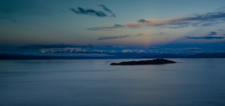
The first of our excursions from La Paz was when Claire was still travelling with us, when we spent a couple of nights around Lake Titicaca. It is the highest navigable lake in the world, and an island in the lake, Isla del Sol, is supposedly the birthplace of the first Incans and is therefore a very important place in Incan History.
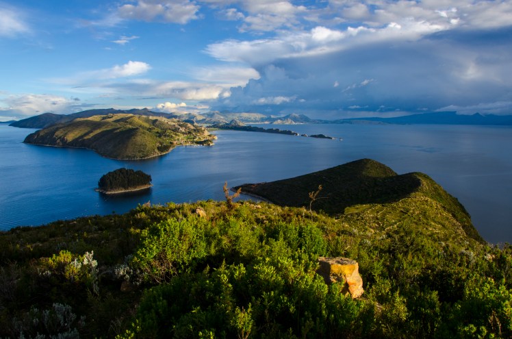
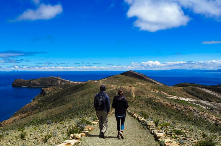
We spent two nights on Isla del Sol, enjoying the special type of calm that comes from staying on an island with no cars. The northern end of the island has some impressive Incan ruins, and we spent a day walking there and back from our hostel located on a ridge of the southern end of the island.
These ruins on the northern side are actually the exact location that, according to legend, the first Incans appeared. Not surprisingly, it was full of tourists, many of whom take one (long) day trip from La Paz.
Most people will end up being an ignorant tourist at some stage, and I’m sure I’ve been guilty of it plenty of times in the past. But armed with the knowledge that a particular rock was where the Incans had made sacrifices, it was funny watching the amount of tourists that stood on the said rock for a group photo. Now everyone give a big smile right at the spot where children were murdered, I thought to myself. Don’t get me started on the yoga poses or 45 degree head tilts.
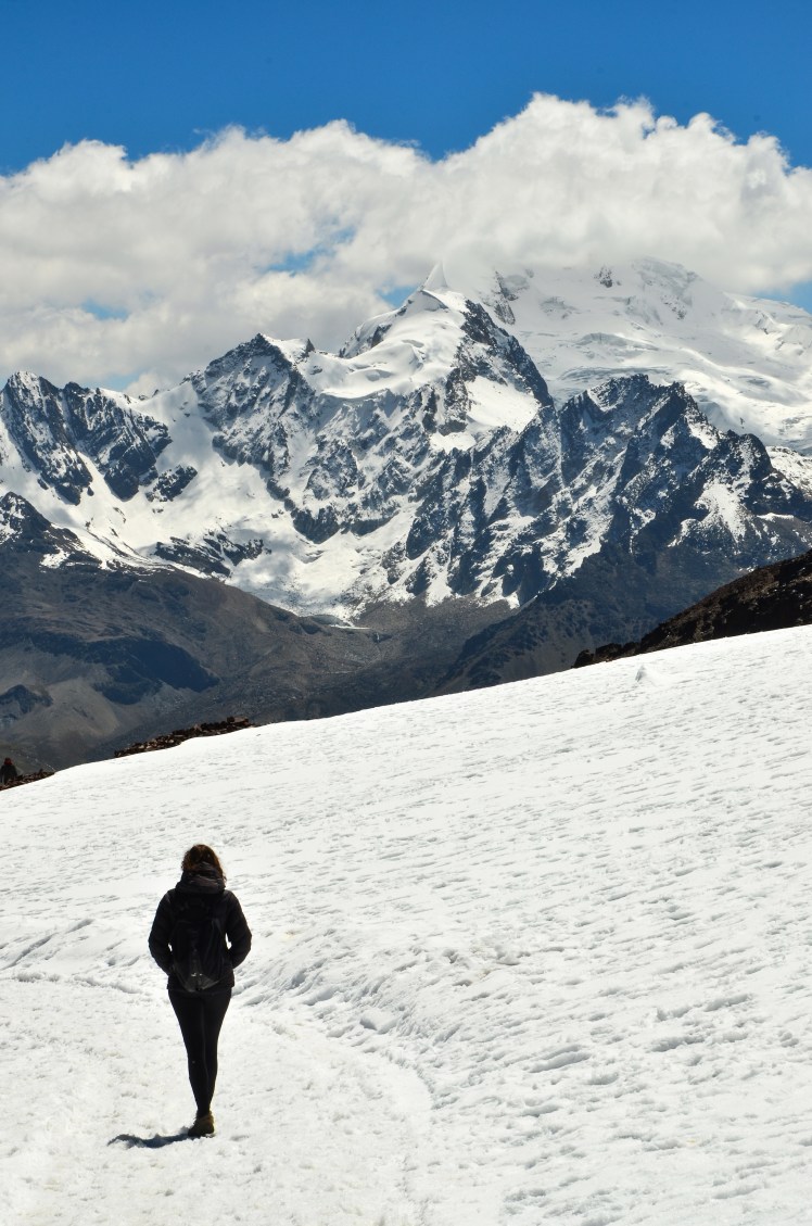
Isla del Sol is not just a historical site, the scenery is also amazing. On a clear day you get great views of the Cordillera Real, with its 6,000m peaks rising up from the lake. One of my highlights from our two days on the island was when we climbed to the high point and enjoyed an hour watching the sunset on one side and the peaks of the Cordillera on the other.

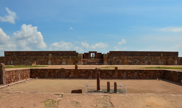
After saying goodbye to Claire and spending time in Sucre, we returned to La Paz and made a day trip to Tiwanaku, the centre of a pre-Incan empire. While lacking the jaw dropping beauty that you get at most Incan sites, it was interesting to learn a bit more about another famous South American group. In avoiding a tour and instead deciding to travel there ourselves, we were also able to take Erin’s favourite form of transportation – the van packed full with 15 people.
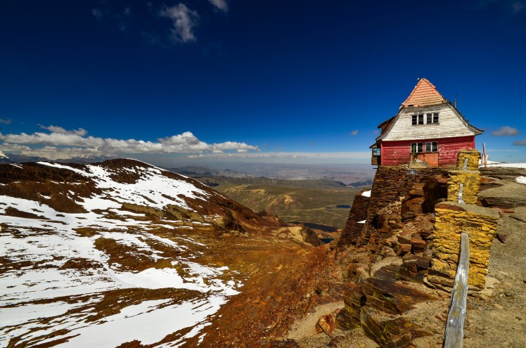
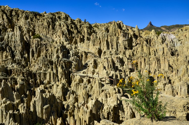
Around this time we also visited two regions that were close to La Paz but couldn’t have had more of a contrast. The first was the 5,400m Mt Chacaltaya, where you are able to catch a bus almost to the summit. The freezing temperatures were definitely worth it for the views of Huayna Potosi and the city of El Alto. I also feel very comfortable in saying that with the 15 minute walk to the summit I will never climb an easier peak above 5,000m. The second was the Moon Valley located to the south of La Paz, which wouldn’t have looked out of place in the south of the USA. The fact we visited both of these places on the one day made it particularly surreal.
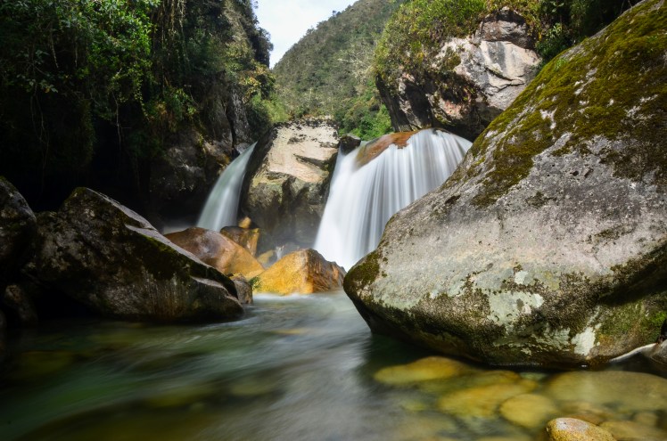
Our final side trip from La Paz was a three day walk along an old Incan Path, known as the Choro Trek. After ignoring the advice of our hostel that it should be done through a tour, we got in a collectivo and asked them to drop us off at the starting point, the 4,600m high pass of La Cumbre.
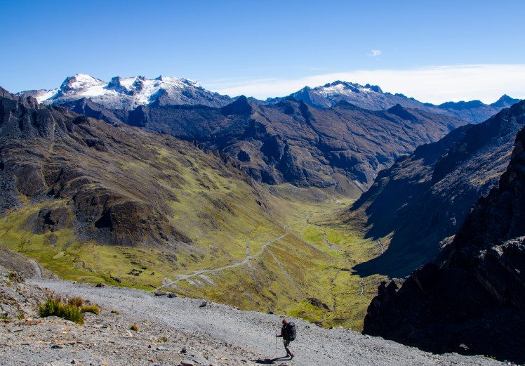
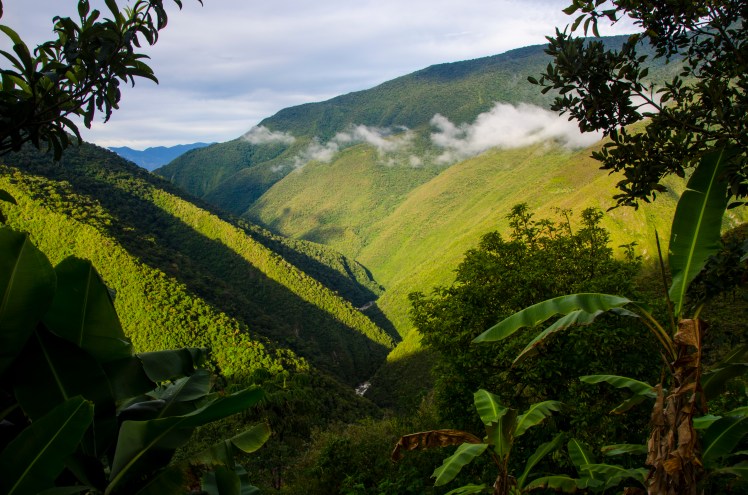
The first hour climbing up to 4,800m with heavy packs was difficult, but from there the track basically went downhill. For three days. The changes in vegetation were amazing. The desolate lifelessness and chilling cold of 4,800m above sea level, complete with snowy peaks that we were fortunate to see given they are often covered in cloud, slowly changed to grassy plains containing numerous Alpacas and Llamas. As we continued to descend, the grass became taller and trees started to appear, and below an altitude of 3,000m we entered the cloud forests of the Yungas region. These forests continued to become thicker and thicker and as we finished the walk, having descended 3,500m in 3 days, we were in a stinking hot jungle.
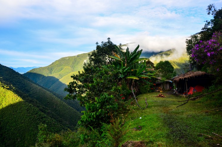
We were lucky with the weather on the trek. As mentioned before, the pass is often cloudy, but we got clear blue sky. We were also told that it always rains in the Yungas, and we did experience four hours of heavy rain, but the rest of the trek was dry. In any case, the infrastructure along the trail made it pretty easy to deal with rain, with all the camping being undercover, allowing wet clothes to be dried overnight.
The trek was very close to Death Road, the popular mountain biking tour people do from La Paz. I was glad to explore the Yungas at a slower pace, and we hardly saw any people on the trail, a far cry from the groups of 15 or 20 that ride down Death Road.
After finishing the trek, instead of jumping straight on a bus back to La Paz we decided to stay a night in Corioco. Relaxing by the hostel pool overlooking the Yungas and with occasional views of the high peaks of the Cordillera Real in the background, it was just the tonic we needed after a few hard days walking. We were pretty sad to say goodbye to Corioco, and it was a fairly difficult transition returning to the utter chaos of traffic in La Paz. By this stage we felt like we’d seen everything we wanted to in La Paz and this time after one night we were leaving the city for good.
Andrew
