In October/November of 2019, Erin, Mum, Dad, Claire and myself undertook the Three Passes Trek in the Khumbu Region of Nepal. The anti-clockwise (and in my opinion far superior) loop follows the Everest Base Camp (EBC) route from Lukla to Namche Bazaar and then up the Khumbu Valley, before splitting off from the EBC trail for the first of the three big passes, the Kongma La. The second big pass (the Cho La) links EBC with another very popular destination in the Khumbu, Gokyo Lakes, before the third pass (the Renjo La) is crossed. Once over the Renjo La, the route makes its way back towards Namche along an old salt trading road linking Nepal and Tibet, and then continues to the end of the trek in Lukla.
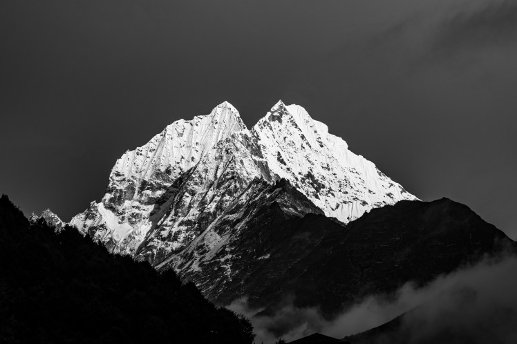
In the lower altitudes, the trail features flowing rivers, swaying suspension bridges and lush forests. Later on there are giant glaciers and emerald green lakes. But it is the mountains that are the star attraction. Four of the six highest peaks in the world are located in the area, and the Three Passes Trek gives you fantastic viewpoints of each of them. In addition, a number of smaller summits (such as Ama Dablam, Pumori and Cholatse) are just as, if not more, impressive than the 8,000m giants.
It is not just about the scenery though. The trek gives an insight into Sherpa culture, with many villages, monasteries and Buddhist monuments encountered along the way. Having said that, the popularity of Mt Everest and the EBC trail have clearly changed the lifestyle and character of these villages and the Sherpa who live there. The traditional agriculture that has dominated for centuries has greatly decreased. In its place are numerous lodges offering a large menu of delicious food and a bed for the night.
The extent of this transformation becomes clear once you step off the EBC trail, with the tourism sector less visible and agriculture more apparent. It is true, however, that the erosion of this culture has coincided with greatly improved fortunes for those who live on, or near, the EBC trail. The Khumbu Region has gone from one of the poorest in Nepal to the richest. Access to education has increased significantly.
Indeed, the younger generation of Sherpas tend to have a variety of career pathways available to them, with many attending university at various institutions across the world. However, that this was made possible by their parents and grandparents being essentially forced (due to it clearly being the highest paying occupation in the region) into dangerous work as mountain guides and porters, and far too many of them dying in the process, left me in a state of confusion about the impacts of tourism in the region. To be honest, even now I still don’t know what to think of it all.
The lodges that have taken over these villages do make the trek much more comfortable than it would otherwise be. You don’t need camping equipment or food (although some extra snacks are advisable) and the quality of bedding and dining greatly exceeded my expectations. The lodges became more basic the higher the altitude, and the additional extras (such as charging, showers, chocolate and beer) became significantly more expensive, but even the highest lodges were still far more comfortable than any night I’ve ever spent in a tent while on a trek.
It is possible to do the trek unguided, but we were very happy with our decision to employ the services of Kaji Sherpa and his team for the trek. It was super convenient having each lodge pre-booked a day or two in advance – and we did see independent hikers having to extend their day’s walk upon learning there were no vacancies in the village they’d planned on spending the night. Kaji was also a great source of knowledge throughout the trek, constantly answering my questions on mountains and mountaineering in the region.
The trek was comfortably the longest any of us had ever done (3 weeks) and the high altitude, particularly sleeping above 4,700m from Day 9 to Day 16, took its toll. All of us developed the notorious “Khumbu Cough”, and there was some real excitement in returning to the warmer, lower altitudes by the end. But this excitement was not in any way related to the quality of the trek. Indeed, if you’re a lover of the mountains, you’d be hard pressed to find a better and more enjoyable trek anywhere in the world.
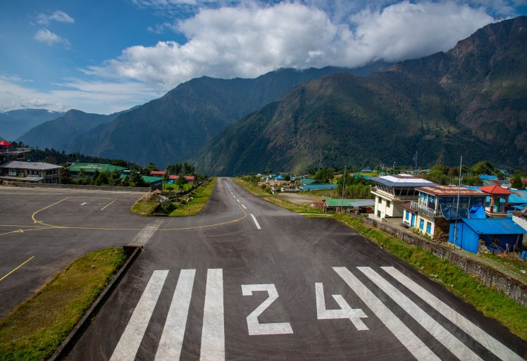
Day 1 – Lukla to Phakding
Referred to as the most dangerous airport in the world, the runway at Lukla Airport has an 11.7 per cent gradient in order to sufficiently slow down (or speed up) arriving (departing) planes.Lunch at one of the many lodges along the trek.
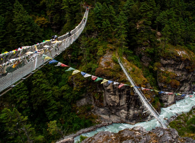
Day 2 – Phakding to Namche Bazaar
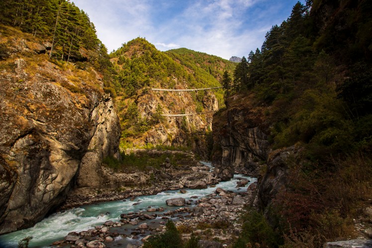
In the first two days, the Dudi Kosh river had to be crossed many times on these narrow suspension bridges. This one was so high there was another bridge visible below.
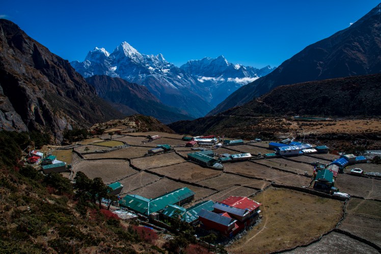
Day 3 – Namche Bazaar to Khumjung, Kunde and back to Namche Bazaar
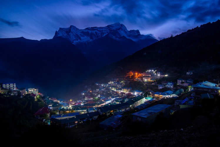
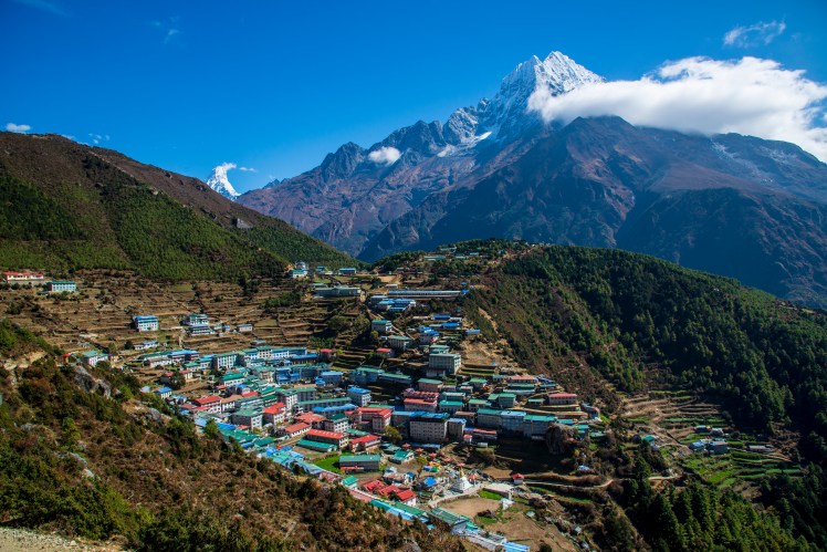
The village of Kunde that we passed through on our first acclimatisation day.The clouds cleared in the afternoon giving us some good views of the surrounding high peaks, including Thamserku (6,623m).Namche Bazaar, the biggest town in the Khumbu and one of the most dramatic locations for a settlement I’ve ever seen, built on a steep slope high above the river below, with the peaks of Thamserku, Kusum Kanguru (6,367m) and Kongde Ri (6,187m) towering above.
Day 4 – Namche Bazaar to Deboche
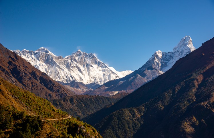
First clear morning of the trek and also our first view of Everest (8,848m, the tiny pyramid on the left), Lhotse (8,516m, the fourth highest mountain in the world and the high point on the big wall in front of Everest) and Ama Dablam (6,812m, the mountain on the right).After arriving in Deboche, we dropped off our gear and walked back up the hill to Tengboche monastery, the largest in the Khumbu and perched on a hilltop with panoramic views of the surrounding mountains.
Day 5 – Deboche to Pangboche
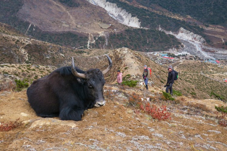
A resting Yak on a ridge above Pangboche
Day 6 – Pangboche to Ama Dablam Base Camp to Pangboche
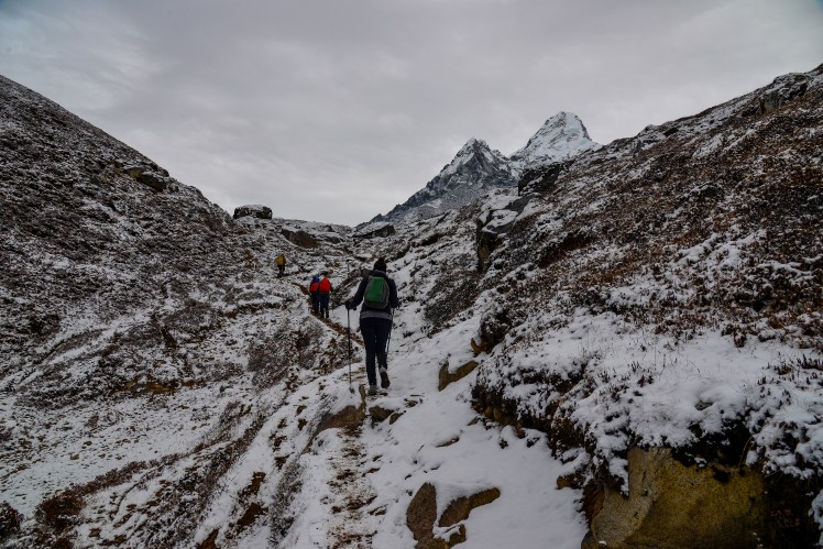
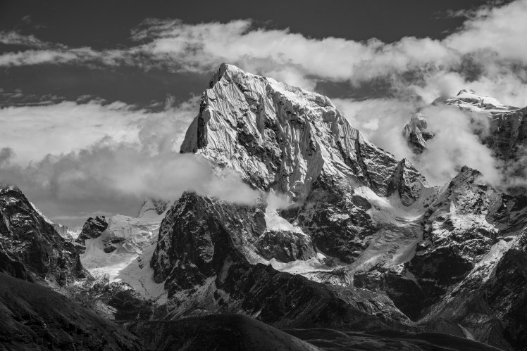
Our next acclimatisation hike was up to Ama Dablam Base Camp, with the track having just received a fresh covering of overnight snow.Ridge above Ama Dablam Base Camp. Taboche (6,542m) dominates the view, while Cho Oyu (8,201m), the sixth highest mountain in the world, is the peak covered in snow in the distance to the right of Taboche.
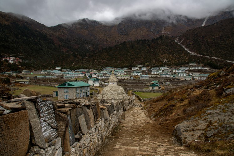
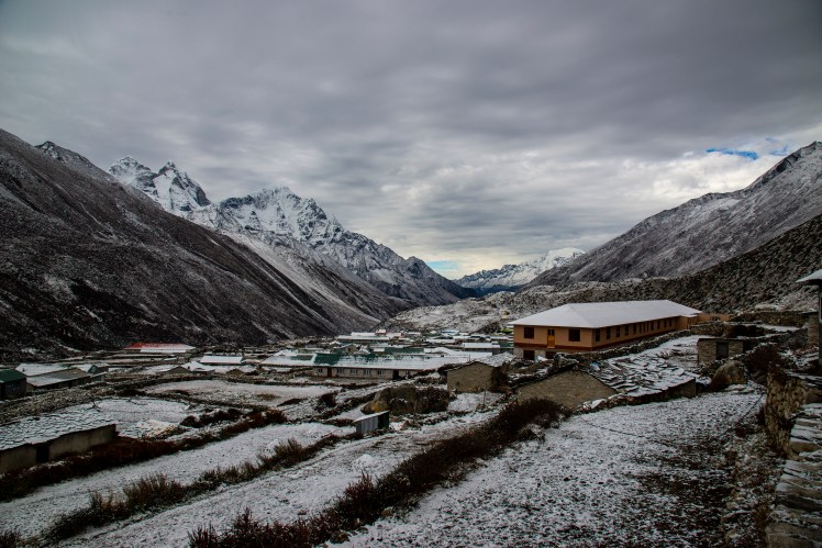
Day 7 – Pangboche to Dingboche
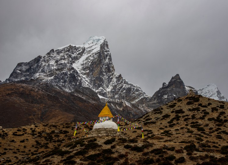
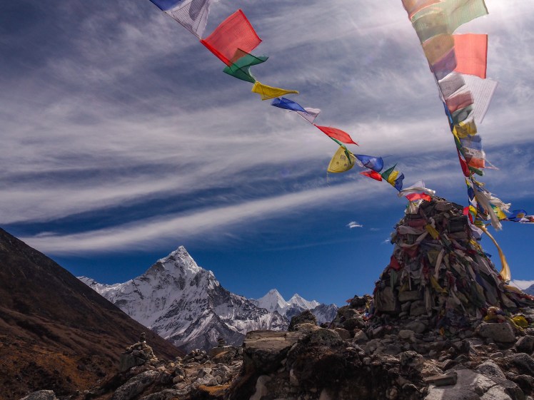
A Stupa near Dingboche. Soon after arriving in Dingboche the threatening skies became a snowstorm and we spent the rest of the day huddled around the yak dung fire in the lodge. Dingboche after the snowfall.
Day 8 – Dingboche to Nangkartshang Peak to Dingboche
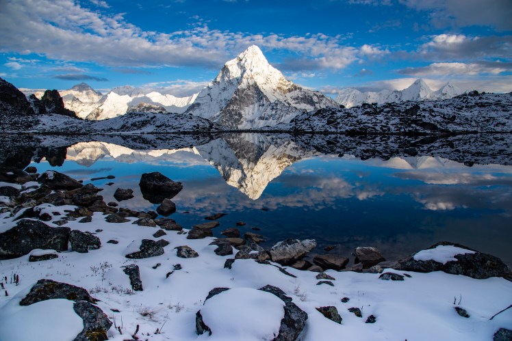
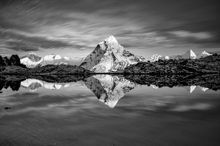
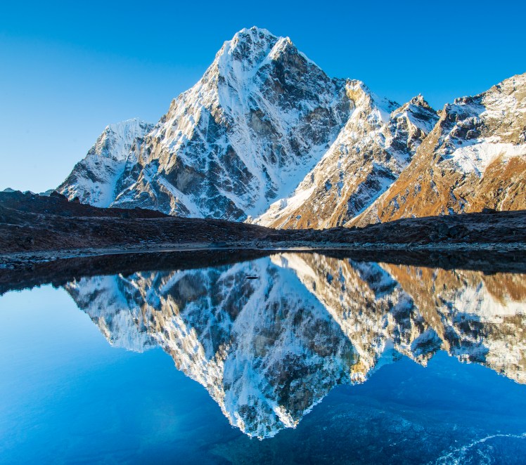
We had another acclimatisation day in Dingboche, climbing Nangkartshang Peak, which had a nice a view across the valley to Ama Dablam.That afternoon I set out on a solo trip to find a lake that I had seen American photographer Jack Brauer (mountainphotography.com) take some amazing photos from. There was no track to this lake, and I wasn’t even sure I was in the right spot, but thankfully after what felt like an endless climb I stumbled upon the lake – and for once it hadn’t clouded over in the afternoon and conditions were so calm that there was an almost perfect reflection of Ama Dablam.
Day 9 – Dingboche to Chukkung to Island Peak Base Camp to Chukkung
A break on the walk towards Island Peak Base Camp. Erin over-exerted herself and ended the day with a very nasty headache that had us wondering if we would need to descend to lower altitudes.Erin with the imposing South Face of Lhotse towering above.
Day 10 – Chukkung to Chukkung Ri to Chukkung
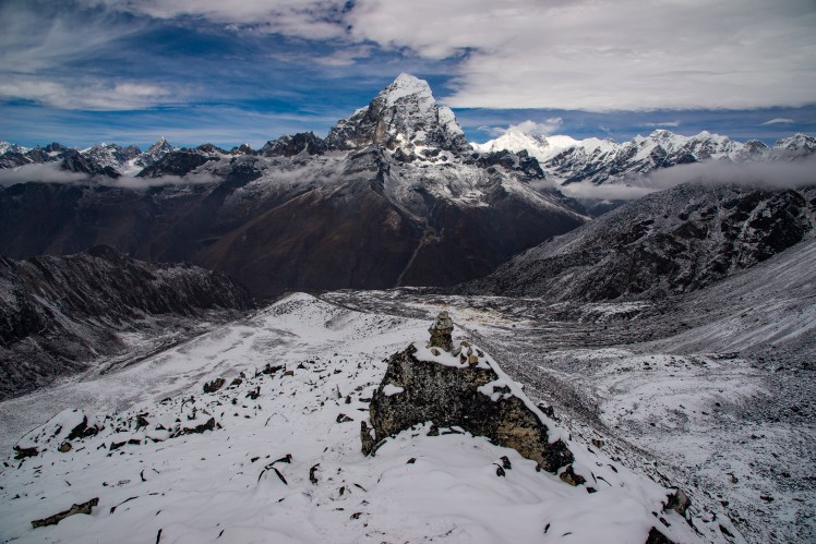
View from Chukkung Ri (5,546m) the highest and last of our acclimatisation walks. Makalu (8,481m), the fifth highest mountain in the world, is the rock pyramid in the distance on the left of the photo.The South Face of Lhotse and Nuptse catching the last light of the sun near Chukkung
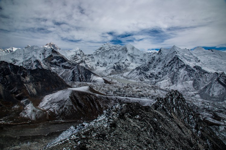
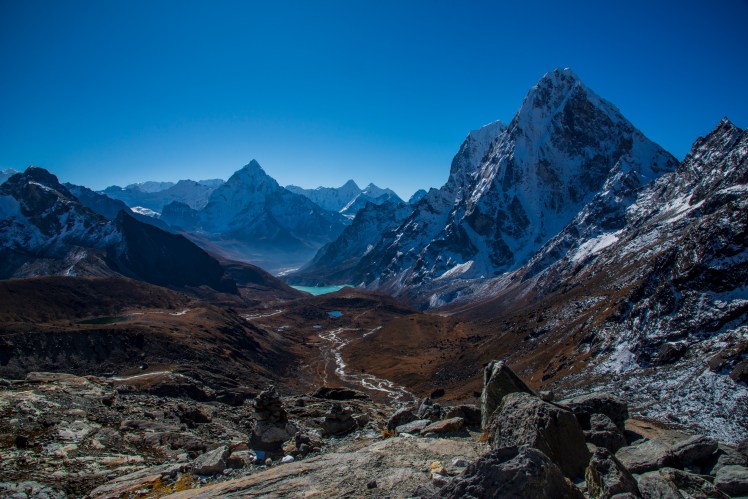
Day 11 – Chukkung to Lobuche via the Kongma La
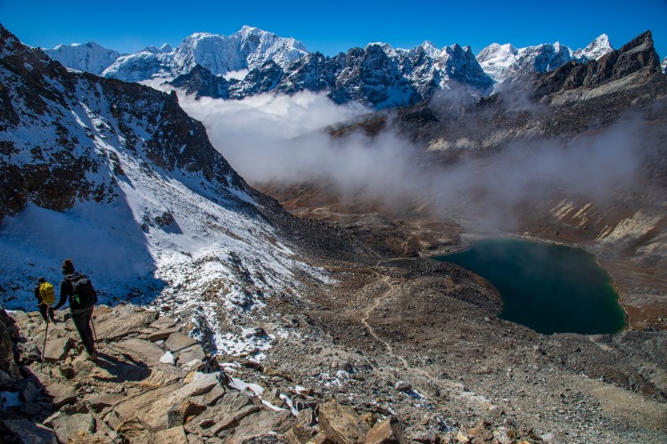
Heading over the Kongma La Pass. Unfortunately Claire and Erin were both quite sick and had to take the slightly lower Duglha Pass instead.MakaluTop of the Kongma La. From here it was a long and very steep descent before a monotonous and undulating crossing of the Khumbu glacier to reach Lobuche.While slightly lower, the Duglha Pass that Erin and Claire took was also spectacular, with great views back to Ama Dablam. It also took them past the Everest memorial, where many Stupas have been built to honour those who have lost their lives attempting to climb to the top of the world.
Day 12 – Lobuche to Gorak Shep
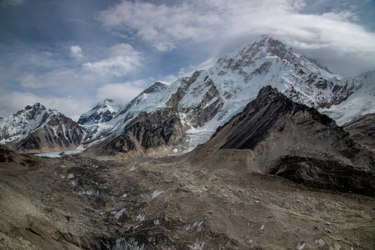
After leaving the Everest Base Camp Trail for a few days, we were back on it for the walk from Lobuche to Gorak Shep. The thin scree covered path with steep ascents and descents through the confluence of the Changri Nup and Changri Shar Glaciers created many bottlenecks, and it was slow going to get to Gorak Shep.They say in the Khumbu that you look towards Everest for the weather forecast – and sure enough not long after this cloud was brewing on the high peaks, we received heavy snowfall and spent most of the day inside and freezing cold (they don’t light the fire in the lodge we stayed in at Gorak Shep until the evening).
Day 13 – Gorak Shep to Kala Patthar to Dzongla
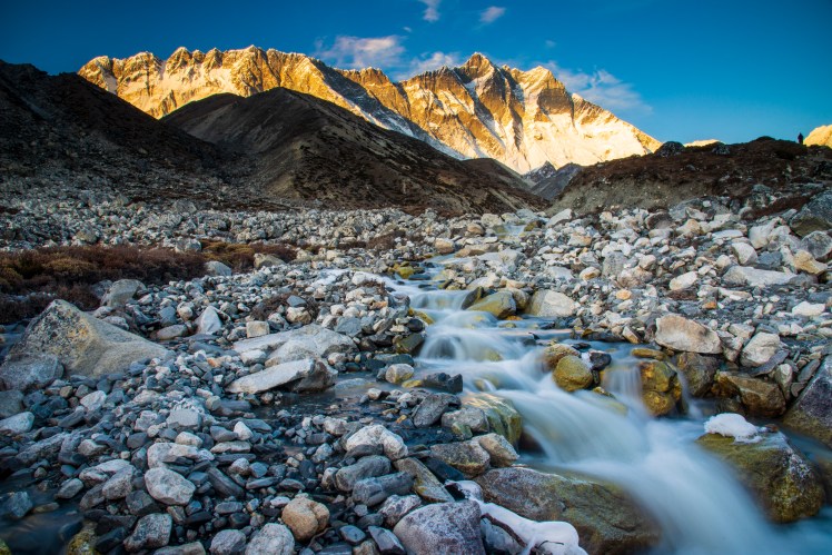
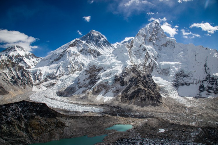
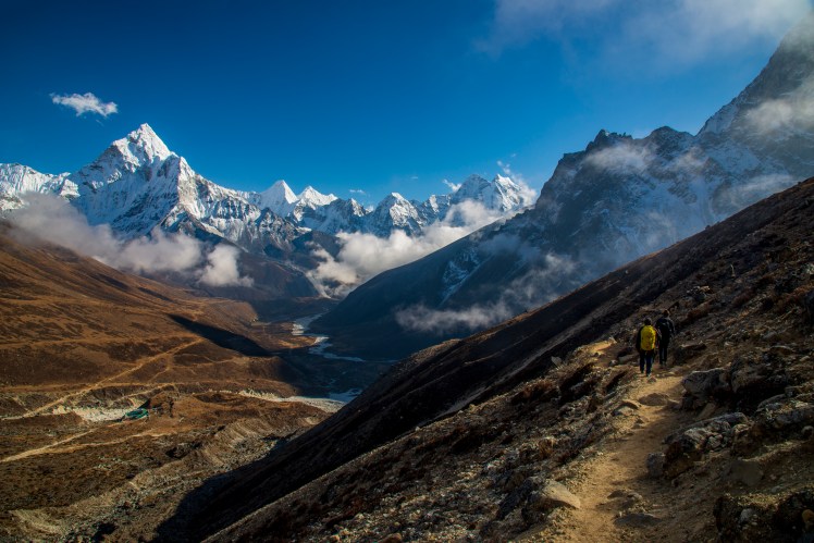
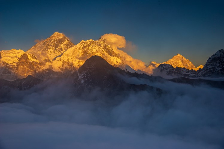
Kala Patthar, the high point of the trek (5,643m) featured an amazing view of Everest, Nuptse (to the right of Everest in the photo) and the Khumbu Icefall. Base Camp is located around the start of the Icefall, while the normal climbing route continues up the Icefall before scaling the right hand side ridge of Everest to the summit. It amazes me that people (or generally tour groups) choose to go to Base Camp instead of Kala Patthar when they only have the option of visiting one. Each to their own I guess.EverestThe section between Lobuche and Dzongla was one of the most spectacular of the entire trek, traversing high up a steep slope with views of Ama Dablam, Taboche and Cholatse (6,440m) on the other side of the valley.
Day 14 – Dzongla to Dragnag via the Cho La Pass
Early morning reflection of Cholatse. It was so cold that I had no dexterity in my fingers and ended up losing my lens cap in the lake.View back towards Dzongla while ascending the Cho La.The Cho La included a glacier crossing just before the top.
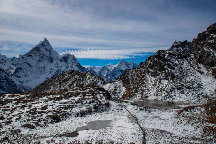
Day 15 – Dragnag to Gokyo
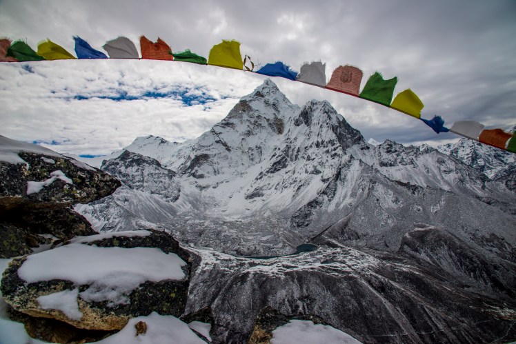
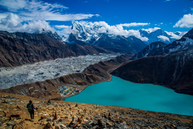
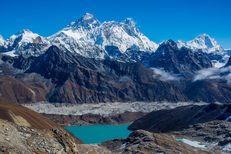
Scree covered glacier crossings, like the Ngozumpa between Dragnag and Gokyo were tedious. Very undulating and slippery underfoot.The town of Gokyo, on the shores of an emerald green lake and featuring views down the valley to Cho Oyu. The green hill with the zigzagging path leading up it is Gokyo Ri, while the path to the Renjo La (the third pass) traverses the lower slopes of Gokyo Ri and continues to the left of this picture.I climbed Gokyo Ri for sunset in the hope that it would be possible to get above the cloud that had settled over the town. This luckily proved to be true and I enjoyed a spectacular (albeit brief as it did cloud over not long after this) twilight watching the last light of the sun catch the huge peaks on the other side of the valley.Gokyo Ri is one of the few places where you can see four 8,000m peaks from the one viewpoint. Everest, Lhotse and Makalu are all pictured here.
Day 16 – Gokyo to Gokyo Ri to Gokyo
We all ascended Gokyo Ri on our second day in Gokyo. Erin here is pictured on the descent, with the Ngozumpa glacier that we crossed on day 14 running between Gokyo and the mountains behind.Cholatse
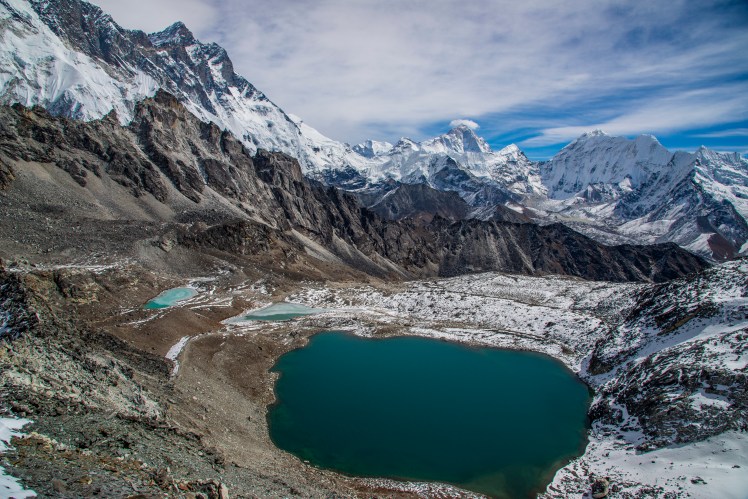
Day 17 – Gokyo to Gokyo Upper Lakes to Gokyo
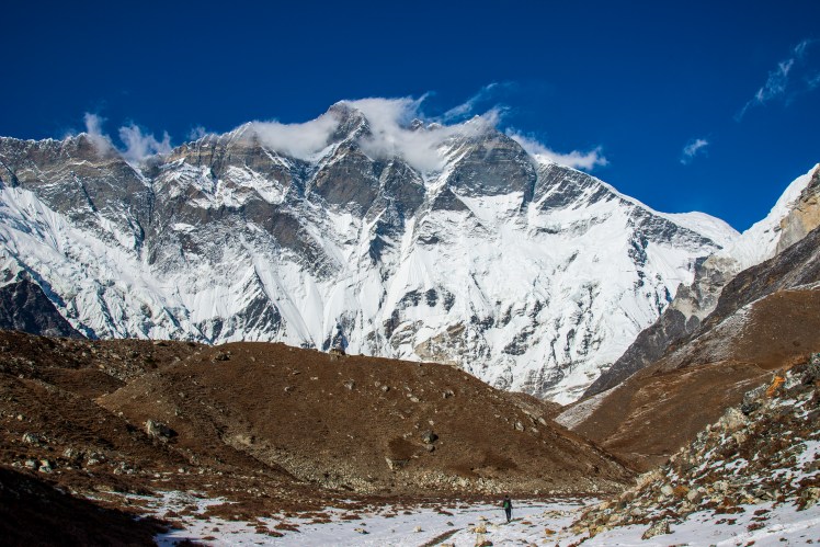
Our third day in Gokyo saw us explore the Upper Gokyo Lakes, which gave another slightly different perspective of Everest. The saddle between Everest and Lhotse (to the right of Everest) is the South Col, where the fourth (and final) camp is located for those attempting the summit.
Day 18 – Gokyo to Lunden via the Renjo La
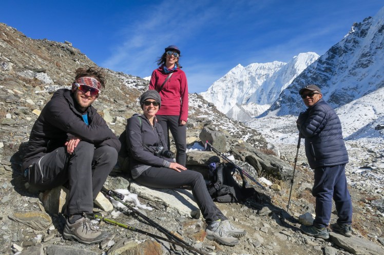
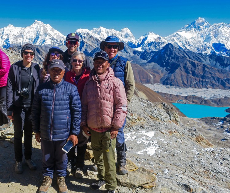
The start of the Renjo LaThe Renjo La was probably the easiest of the three big passes, although with fatigue setting in after such a long period of time at high altitude it certainly wasn’t easy. The payoff though was one of the best viewpoints of the entire trek at the top. Everest, Lhotse and Makalu in the background, with the Ngozumpa glacier and Gokyo along the shores of the emerald lake in the foreground.Kaji Sherpa (Guide), Furwa Sherpa (Assistant) and the rest of us on top of the Renjo LaDescending the Renjo La. It was pretty much downhill from here all the way to Lukla.
Day 19 – Lunden to Thame
One of the many Mani Walls during the trek.Far from the Everest Base Camp trail, Thame felt like it belonged to a different era, with fewer lodges, kids walking from neighbouring villages to school and an impressive monastery on the hill above the town.
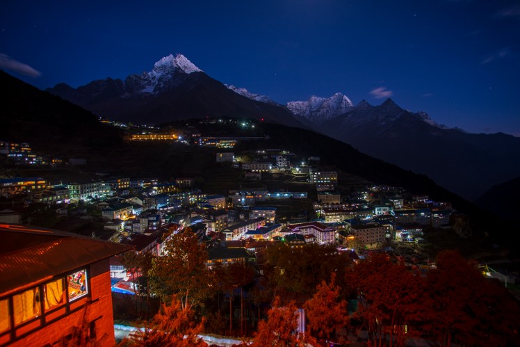
Day 20 – Thame to Namche Bazaar
Back in the familiar surrounds of Namche Bazaar. Only this time the altitude of 3,440m felt low – meaning it was time to go to the pub!
Day 21 – Namche Bazaar to Lukla
Our final day saw us walk from Namche back along the Dudi Kosh to Lukla, with familiar sights such as the double suspension bridge that we crossed on Day 2. This section of the track had taken us two days on the way up, but was easily completed in one on the return leg.Back in Kathmandu